High resolution, high revisit EO data
ORCA will provide multiple daily imagery with a fleet that will frequently cover most high-activity areas in Europe.


Revisit Time
The vast number commercial flights allow for sub-daily image acquisition.

Coverage
Even the fleet of a single airliner has significant coverage potential

Spatial Resolution
Meter class resolution in various spectral bands
Applications & Products

Forest Fire Detection
Early detection of forest fire break-outs

Disaster Relief
Rapid assessment of calamity impact zones to aid disaster response units

Precision Farming
More efficient and sustainable use of valuable resources, such as fresh water

Forestry
Monitoring forest yield and growth, logging activities, or invasive species

Infrastructure Monitoring
Infrastructure providers move from inspection to monitoring

Resource Management
Inventory/stockpile monitoring, reclamation monitoring, hydrology planning
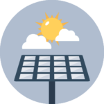
Solar Forecasting
Forecasting solar irradiance to optimise power grid operations
Asset Tracking
Visual inspection of assets complemented by M2M connectivity

Meteorological Insights
Real-time data in the visual and infrared spectrum for improved Nowcasting

Maritime Applications
Detection of plastic gyres or oil spills, AIS services, coastal management and monitoring

Insurance
Risk modeling, damage assessments, property claims, high value asset monitoring

HiRes DSM & 3D Point Cloud
ORCA can produce digital surface/terrain models. An excellent product for 3D city modelling, viewshed analysis, scene analysis and understanding, change detection, risk mapping, and (true) orthoimage generation.
Medium Class Thermal Orthos
ORCA can produce medium-high GSD Thermal Orthos, allowing clear discrimination between water, rocks, vegetation types and man-made structures with low albedos, which generally appear dark in the visible and NIR spectrum.


Fused Optical & Thermal
Fusion of Optical and Thermal products yield a suite of products where information is significantly more reliably extracted than can be extracted from either source alone. The THO Ortho is draped onto the MUO Ortho, where vector information is also overlaid onto the MUO.
Asset monitoring with ORCA OptiTherm
Ensure your assets are safe. ORCA is truly disruptive, as it is the only platform providing co-registered optical and thermal imaging. This, in combination with multiple daily data acquisition, makes it the ultimate system to ensure the safety of your critical assets.
